The Safety Data API
Developers Depend On.
200M+ safety data points from 8 federal sources — unified into one REST API. Emergency facilities, real-time hazard alerts, air quality, seismic activity, wildfire tracking, flood zones, and composite risk scores across all of North America. One key. One schema. Zero stitching.
Real-time data from 8 U.S. federal agencies — the same sources that power national emergency systems
In 2015, HTTPS was optional. By 2020, browsers flagged it as negligence. Safety data for location-aware apps is on the same trajectory.
Six Modules. One Key. Zero Government Paperwork.
Everything you need to build safety-aware applications. Each module replaces weeks of government API integration work.

Hazard Alerts
Every FEMA, NOAA, USGS, and NIFC alert — normalized, geocoded, and delivered in under 50ms. No more parsing CAP XML or polling 4 different endpoints.
GET /v1/alerts

Incident Reporting
Let users report what sensors can't see. Community-powered safety data with auto-geocoding, severity scoring, and status tracking.
POST /v1/incidents

Geofence Safety Zones
Virtual perimeters that trigger alerts when conditions change. Wildfire approaching a job site? Severe weather near a delivery route? Your app knows first.
POST /v1/geofences

Location Intelligence
A composite 0–100 safety score from 7 weighted risk factors. The data that major real estate platforms removed — now available via API for any coordinate.
GET /v1/location/risk-score

Emergency Contacts
Hospitals, fire stations, EMS, police, pharmacies, urgent care, poison control, and 911 centers — 220,000+ verified and geocoded facilities across the US, Canada, and Mexico. Nearest facility by type with distance, phone, and address in a single call.
GET /v1/contacts/nearest

Webhooks & Streaming
Real-time push. Your app reacts to threats as they emerge — not when users refresh. HMAC-SHA256 signed payloads with automatic retry.
WS /v1/stream
Every Location-Aware App
Has a Blind Spot.
Your app knows WHERE users are. SOSRoute tells you what's AROUND them.
"A driver entered an active wildfire evacuation zone because the routing algorithm didn't know. The NIFC data was public. The app didn't use it."
What would that headline cost your company?
"She picked a meeting spot. Nobody told her the area had the highest crime index in the city. The FBI data was available. Your app showed her a map with a pin — nothing more."
The data existed. Did your app use it?
"Tourists booked a beachfront hotel during hurricane season. NOAA issued a tropical storm warning 6 hours later. Your travel app sent a booking confirmation — not a warning."
Your competitor added real-time safety alerts. When will your users notice you didn't?
"Redfin and Trulia removed crime and environmental risk data from their platforms. First-time buyers are flying blind. The gap is wide open for any app willing to show the truth."
The majors walked away. The market didn't.
"A pedestrian wearing smart glasses walks toward a flooded underpass at night. The FEMA flood zone data existed. The NOAA flash flood warning was active. The glasses showed turn-by-turn directions — straight through it."
Spatial computing without spatial awareness isn't smart — it's dangerous.
"A firefighter arrives on scene. The heads-up display shows the nearest trauma center is 4.2 miles northeast. Hazmat classification, wind direction, and the poison control hotline — all in the visor before boots hit the ground."
The data is there. Put it where their eyes already are.
Endless Developer Uses
One API. Every category of app. See how safety intelligence transforms the products your users already depend on.
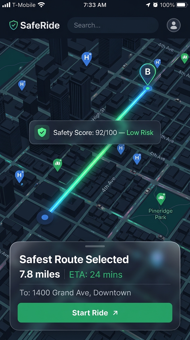
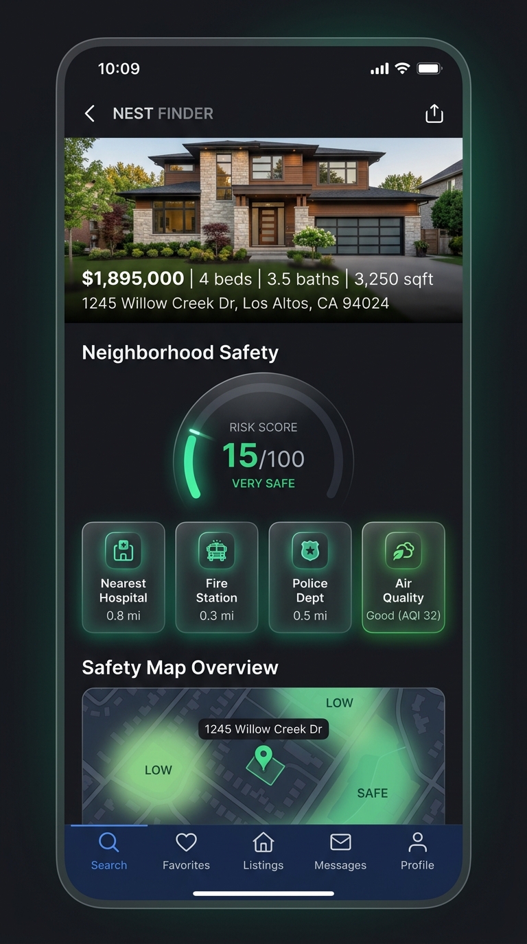
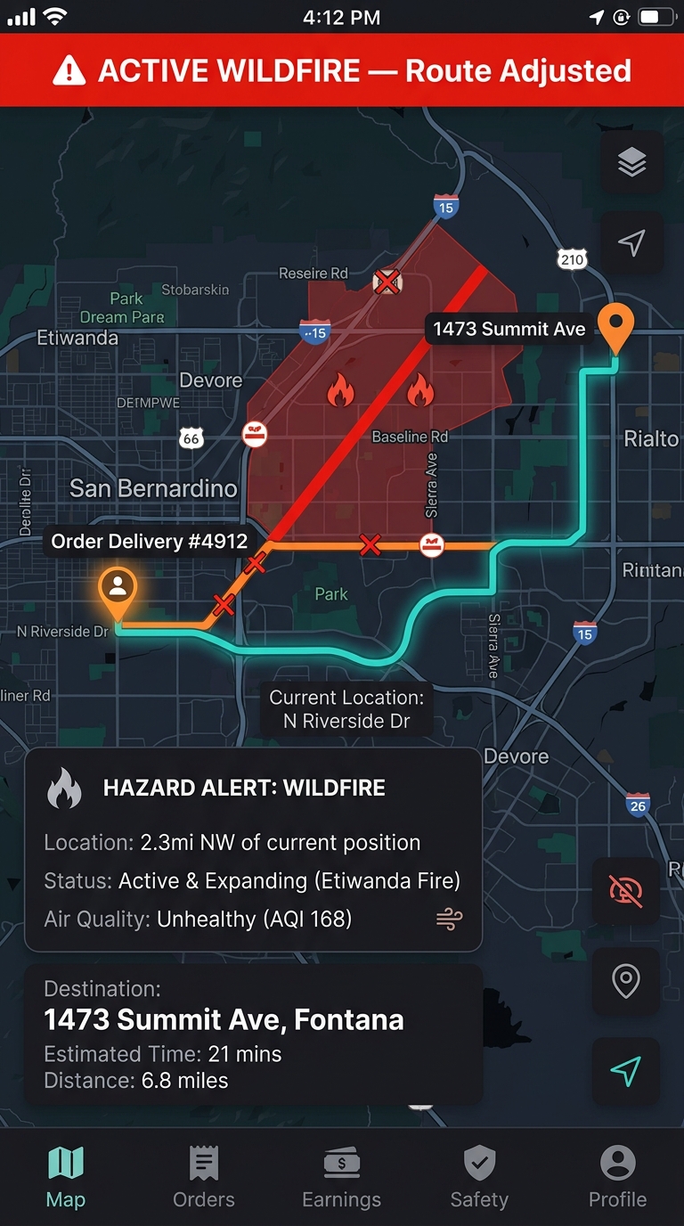
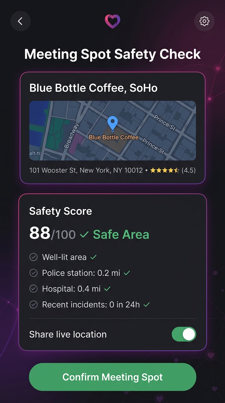
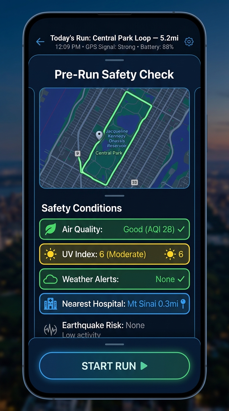
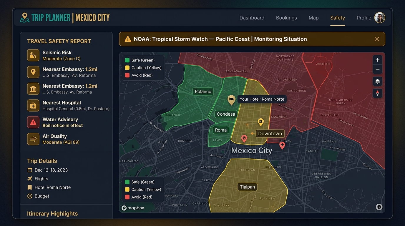
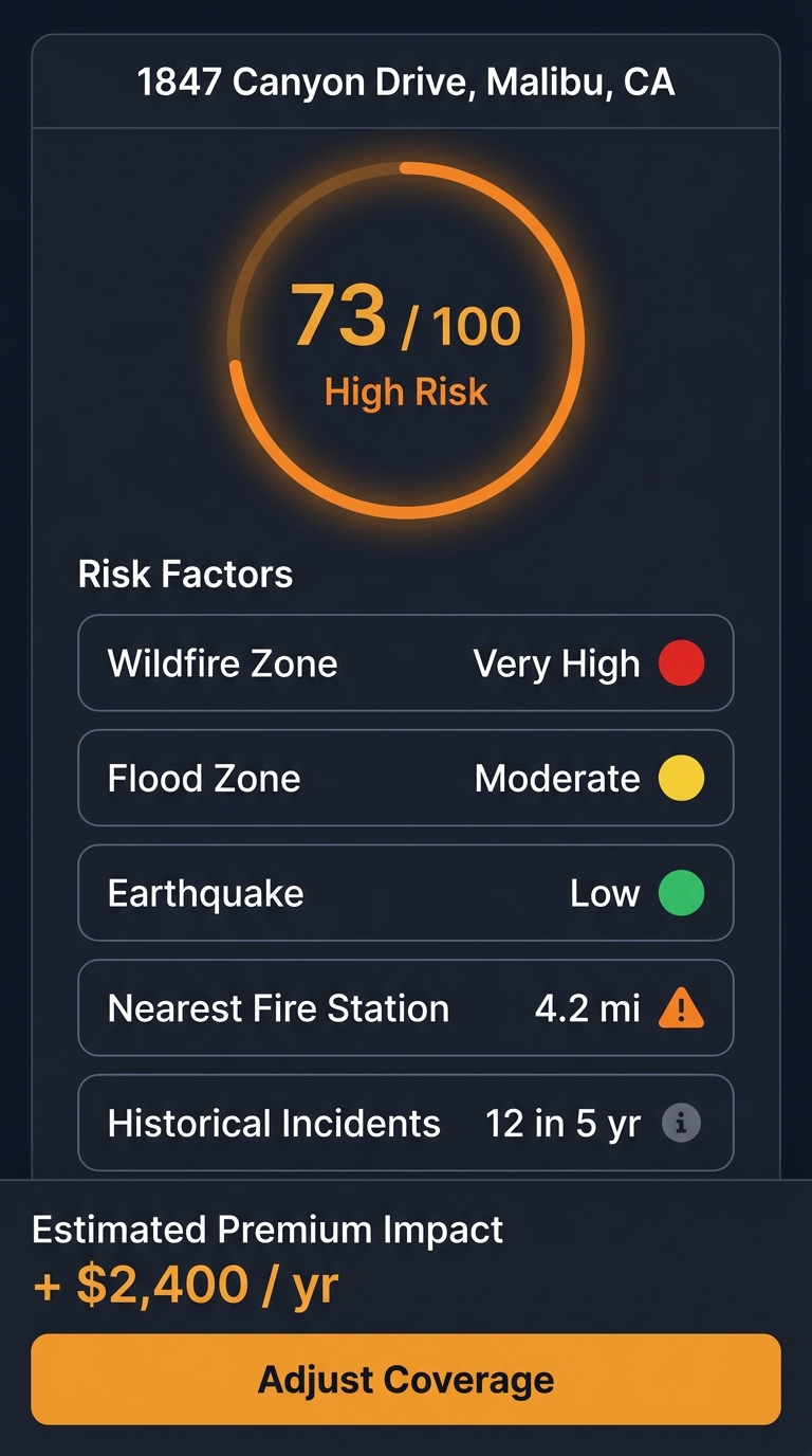
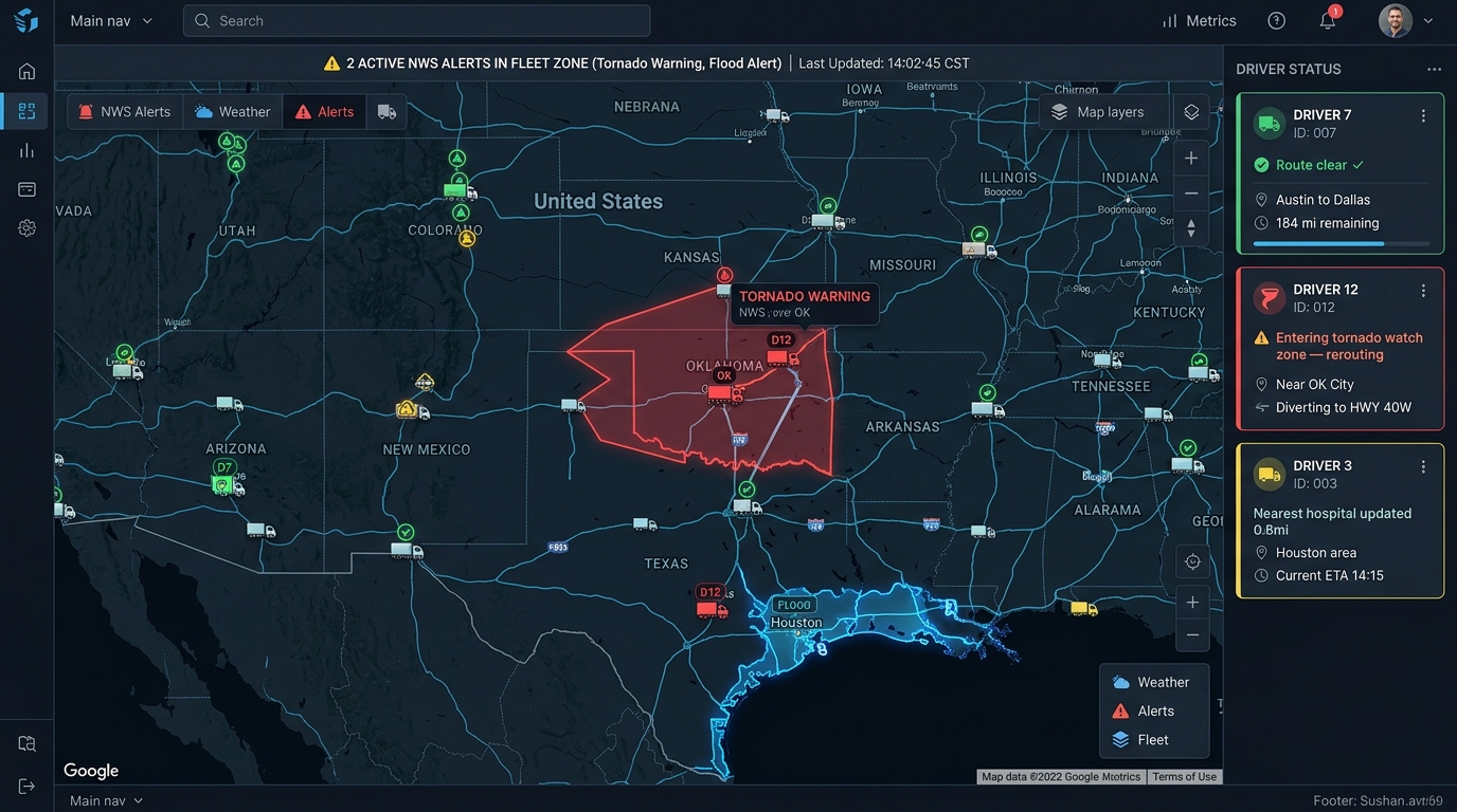
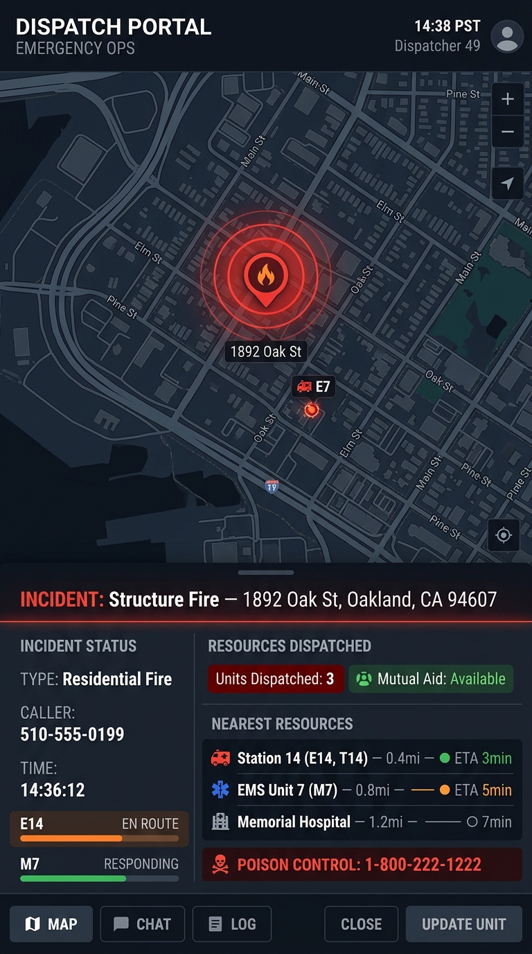
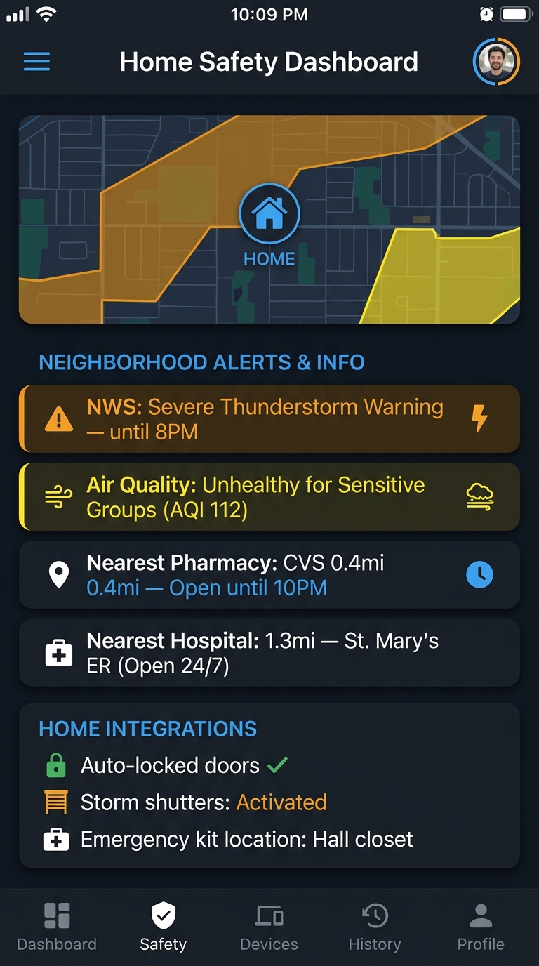
Each mockup powered by a single API call — GET /v1/contacts/nearest, GET /v1/alerts/active, or GET /v1/location/risk-score
See It In Action
One request. Structured safety data. <50ms average response time — faster than you can blink.
You Could Build This In-House.
3 engineers. 6 months. 8 data sources. 8 auth systems. 8 data formats. 8 rate limiters. Or…
6+ months to production
- 3 engineers at $140K+ salary
- FEMA IPAWS registration & CAP XML parsing
- NOAA API integration & GeoJSON normalization
- USGS Earthquake polling & deduplication
- FBI UCR quarterly data pipeline
- EPA AirNow hourly ingestion
- PostGIS geospatial queries from scratch
- Rate limiting, caching, monitoring
- Ongoing maintenance & data source changes
5 minutes to first API call
- All 8 data sources, pre-normalized
- One consistent JSON schema
- One API key, one set of rate limits
- PostGIS-powered geospatial queries built in
- Real-time webhooks & WebSocket streaming
- 220,000+ emergency facility database
- SDKs in 6 languages + MCP server
- 99.95% uptime SLA
- We handle maintenance & data source changes
Simple, Predictable Pricing
Start free. Scale as you grow. No surprises.
Free forever
Perfect for prototyping and exploration.
- 1,000 calls/day
- All read endpoints
- 2 webhooks
- Community support
- Standard rate limits
Less than $0.001 per call
For indie devs and small teams shipping real products.
- 50,000 calls/day
- All endpoints
- 10 webhooks
- WebSocket streaming
- Email support
Less than $0.0004 per call
For growing teams that need reliability and speed.
- 500,000 calls/day
- All endpoints
- Unlimited webhooks
- Priority support
- 99.9% SLA guarantee
Volume discounts available
Dedicated infrastructure for mission-critical operations.
- Unlimited API calls
- Dedicated infrastructure
- Custom SLA
- SSO / SAML
- Dedicated account manager
Your Users' Safety Data Deserves
Enterprise-Grade Protection.
Built on hardened infrastructure with defense in depth at every layer. Startup-friendly pricing, enterprise-grade security.
-
✓
Cloudflare WAF + DDoS Protection
Enterprise-grade edge security with automatic threat mitigation.
-
✓
TLS 1.3 Encryption
All data in transit encrypted with the latest TLS standard.
-
✓
AES-256 Encryption at Rest
All stored data protected with AES-256 encryption. Keys managed via hardware security modules.
-
✓
RBAC API Keys
Fine-grained role-based access control for every API key scope.
-
✓
Enterprise-Grade Infrastructure
Built on SOC 2-compliant cloud infrastructure with continuous security monitoring.
-
✓
Comprehensive Audit Logging
Full request logging with tamper-proof audit trails.
Built for Developers
From signup to first API call in under 5 minutes. Full OpenAPI 3.1 spec. Auto-generate clients in any language.
5-Minute Quickstart
Install the SDK, configure your key, and make your first call. Full sandbox environment with synthetic data — no rate limits, break things safely.
SDKs & MCP Server
First-class SDKs with TypeScript definitions. Plus an MCP server that works with Claude, Cursor, Windsurf, and every AI coding assistant.
Interactive Docs
Full request/response examples for every endpoint. OpenAPI 3.1 spec for auto-generating clients. AI-optimized documentation via llms.txt.